| First Method |
|
|
 |
|
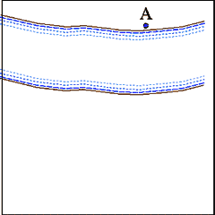
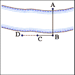
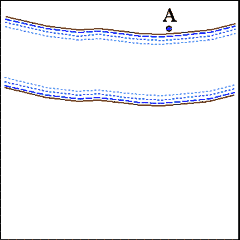
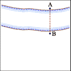
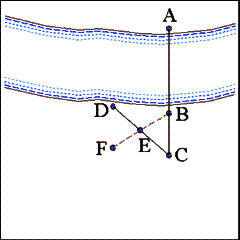
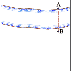
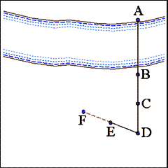
Select a prominent object (Point A) such as a large tree
or house as the base point on the opposite side of the terrain feature (a
river in the example) that prevents an accurate measure from being taken. |
 |
|
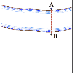
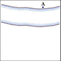
Select a second point (Point B) on the near side of the inaccessible
terrain feature as the second base point for estimating the unknown distance
between the first and second base points. |
 |
|
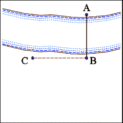
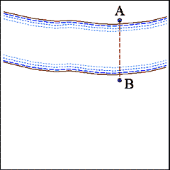
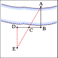
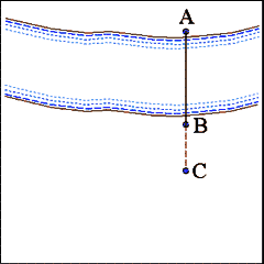
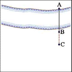
From Point B advance along a line perpendicular to the direction
of the distance between estimated (Line AB) any convenient distance to Point
C. Set up a picket at or otherwise mark the position of Point C. |
 |
|
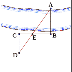
From Point C continue to advance along the same line a distance
equal to the distance between points B and C. Mark the terminal point of
this distance as Point D. |
 |
|
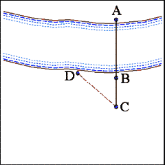
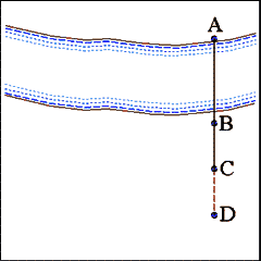
From Point D advance along a line perpendicular to Line BD until
reaching a point (Point E) where the object at Point A is exactly covered
by the picket set up at Point C. |
 |
|
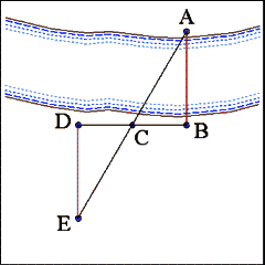
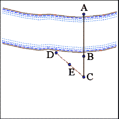
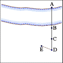
Measure the distance between points D and E. By similar triangles
(ABC = EDC) the Line DE will nearly equal the unknown distance between points
A and B. |
| Second Method |
|
|
 |
|
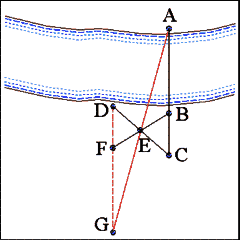
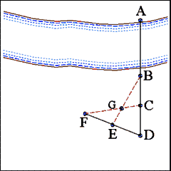
Select a prominent object (Point A) on the far side of the river
or terrain feature that is inaccessible |
 |
|
Select a second point (Point B) on the near side of the inaccessible
terrain feature that will serve as the base point for laying out similar
triangles that will allow a close estimate of the width of the inaccessible
terrain feature (Line AB). |
 |
|
Advance along a continuation of the Right Line AB any convenient
distance and mark the stopping point (Point C) with a picket. |
 |
|
From Point C advance along a line that is oblique to Line AC and
in the general direction of the inaccessible terrain feature. Mark the stopping
point (Point D) with a picket. |
 |
|
Measure the distance between points C and D and mark the halfway
point (Point E). In the illustration CE = ED. |
 |
|
Move back to Point B. From Point B advance along a right line
toward Point E, carefully measuring the distance between points B and E.
On reaching Point E continue along the same line a distance equal to Line
BE and mark the stopping point (Point F) with a picket. |
 |
|
Carefully take up a position near Point F at which the picket
marking Point F exactly covers the picket at Point D. Advance along the
continuation of Line DF (heading away from the inaccessible terrain)
until reaching a point (Point G) at which the picket at Point E exactly covers
the object at Point A. |
 |
|
Measure the length of Line FG. By similar triangles Line FG should
nearly equal the unknown distance between points A and B. |
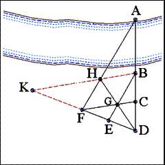
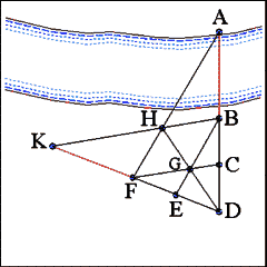
| Third Method |
|
|
 |
|
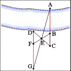
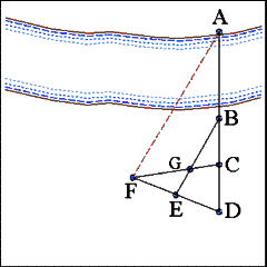
Select an object (Point A) on the far side of the inaccessible
terrain to use as a base point for estimating the width of the ground that
can not be directly measured. |
 |
|
Select a second point (Point B) on the near side of the inaccessible
terrain to use as a second base point and set up a picket at that point.
The distance between points A and B taken on a right line will be the distance
actually estimated. |
 |
|
Advance along a continuation of Line AB any convenient distance
to Point C and mark the point with a picket. Measure the distance between
points B and C. |
 |
|
Advance along a right line continuation of Line AC, keeping points
A, B, and C carefully aligned, a distance equal to the length of line segment
BC (BC = CD). Mark the terminal point (Point D) with a picket. |
 |
|
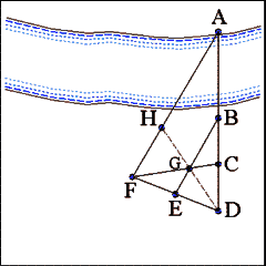
Advance from Point D along a right line at an oblique angle to
the direction of Line AD a distance equal to the length of line segments
BC and CD. Mark the distance with a picket (Point E). |
 |
|
From Point E advance along a right line continuation of Line DE
a distance equal to the length of Line DE. Mark the end point with a picket
(Point F). (BC = CD = DE = EF) |
 |
|
Trace right lines to join the pickets at points B to E and points
C to F. This is best accomplished using cord or rope that can be attached
to the pickets and drawn tight. Mark the point where the two lines intersect
with a picket (Point G). |
 |
|
Move to a position near the picket at Point F. Carefully align
the picket at Point F so that it covers the object at Point A. Tie a cord
to the picket and have an assistant advance directly toward Point A until
he reaches a position close to the edge of the inaccessible ground, making
sure that he keeps the cord tight and straight as he advances. Drive a picket
at the stopping point and attach the cord to it. It is not necessary to assign
any designation to this picket point since the cord only traces the position
of Line AF. |
 |
|
Move to a position near Point D and align points D and G. Advance
along a right line from Point D to Point G and continue in the same direction
until reaching the cord marking Line AF. Set up a picket where these two
lines (AF and DG...) intersect (Point H). |
 |
|
Once again using cords to insure greater accuracy mark right lines
connecting the pickets at points B to H and E to F and extend those cords
along right lines until they intersect. Mark the point (Point K) where they
intersect with a picket. |
 |
|
By similar triangles (FHK and BHA) the length of Line FK will
closely approximate the distance between points A and B. |