~Introductory Remarks ~
Fort Jackson also called "Old Fort Jackson" and "Fort James Jackson"
to distinguish it from all the other Forts Jackson (masonry and modern) was
constructed from 1808 to 1812 as a second system river defense fortification
capable of sustaining a land attack of short duration. Its primary purpose
was to oppose a hostile fleet ascending the Savannah River with the intention
of either bombarding the city or landing an army to attack and occupy the
place. With this object in mind Fort Jackson was designed to oppose the passage
of a hostile fleet by engaging it with heavy sea coast artillery mounted
and elevated well above the river's high water mark on a six face open water
battery while defending against a land attack from an irregular quadrilateral
demi-bastioned masonry enclosure that was crenellated for small arms defense
and embrasured for light artillery on the flanks of the demi-bastions.
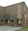
Defense of the fort was supplemented by a revetted wet ditch that
was fed by water drawn from the Savannah River through a tide tunnel; the
wet ditch combined with the height of the crenellated walls (approximately
22 feet) would have effectually prevented any attempt to capture the work
by escalade and compelled an attacking force to erect siege batteries and
batter one or more breaches in the scarp wall before an assault could take
place. Ground in the immediate vicinity of the fort was generally level and
cut into rice fields that would have materially impeded any assault and created
certain challenges in the construction of breaching batteries. Since the
crenellated walls were not covered by a glacis breaching operations could
be conducted at ranges up to 1,000 to 1,200 yards using heavy smoothbore
siege artillery and at much longer ranges by rifled artillery. Rifled artillery
positioned near Causten's Bluff or McQueen's Island (slightly over one mile
and two miles distant) combined with heavy siege mortars would have been
able to breach the landside scarp walls and attack the free standing powder
magazine and rear of the casemates to compel a capitulation in a matter of
hours once the batteries of the attack had been completed.
Fort Jackson's position on the river was favorable to a good land
defense at the time of its original construction, but was primarily selected
to fulfill its role as a river defense fortification. An earthwork fortification
had been constructed at Fort Jackson's location to defend Savannah during
the War of 1812; the position itself was suggested by the fact that the British
fleet that attacked Savannah in 1779 disembarked its land force near the
fort's position prior to its successful advance against the city. It would
have been difficult to improve upon the fort's position to increase its ability
to resist an attacking fleet. Fort Jackson was located at the narrowest point
in the river between the confluence of the Front and Back Rivers upstream
and the separation of the Savannah River into its north and south channels
at Elba Island. The position was also the farthest point from the city that
could not be taken in reverse by an advance using the network of creeks and
streams to the east and south. Although the fort looked out over one of the
deepest points in the river its site provided every advantage to the defense
that nature could offer between Savannah and the sea.
As a second system fortification the design and construction of
Fort Jackson was the work of a single engineer or successive series of engineers
whose work was not subject to review by a board of experienced engineers.
It was an individual effort and bears the mark of the guiding engineer's
experience or inexperience, his talent for the task or lack of talent and
foresight in turning the natural advantages of the selected site to good
account within the limits imposed by budgetary restraints. Given the fort's
primary object of opposing a hostile fleet it appears from the structure
itself that rather too much attention and expense was concentrated on the
design and construction of the water battery. The water battery wall was
traced with six faces and five salient angles with the longest face enabling
the work to engage enemy ships as they sailed upstream toward the fort; two
faces engaged the river immediately in front of the front and one other would
insure that any ships attempted to pass the work could be taken stern on
as they headed toward the city. Short faces at either end of the trace prevented
ships from hugging the river bank to engage the opposite ends of the water
battery with reverse fire. Unlike third system masonry fortifications that
depended upon a single wall to shelter the work from enemy fire, Fort Jackson's
engineer designed a thick masonry enclosure packed with earth fill that did
nothing more than support the water battery's parapet and close the end of
the battery's casemates. Concentric arched vaulting of the cramped casemates
supported the water battery's terre-plein in rear of the interior enclosure
wall and provide the space needed to mount the fort's designed armament of
14 heavy sea coast guns. The masonry enclosure create a double wall effect;
a hostile fleet finding it desirable to breach the water battery wall would
be required to breach two walls and blast away the earth fill between them
to open the interior of the fort to its close and direct fire. Given the
fact that shell guns were hardly an artillerist's dream at the time when
the fort was constructed, the double wall imparted an extra measure of protection
to the interior of the work that no fleet, it was probably hoped, could
reasonably challenge.
|
|
|
|
~ Exterior Views ~ |
 |
|
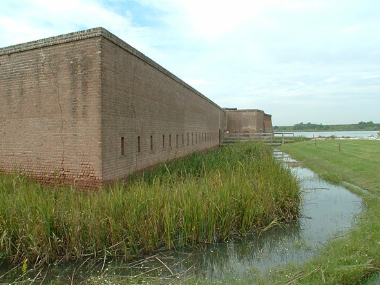
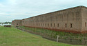
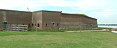
General View, West Front. Savannah River to the Left. |
 |
|
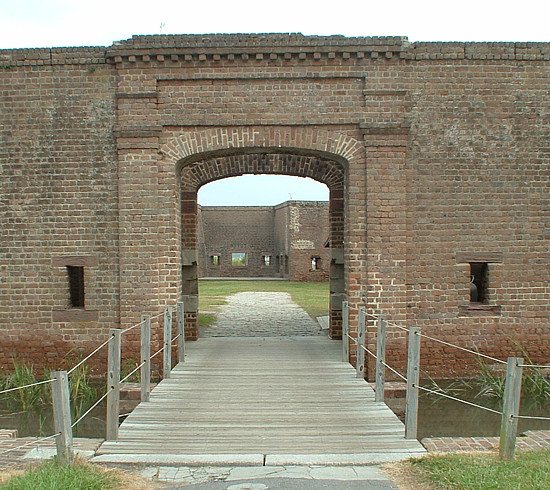
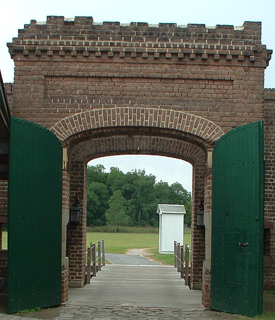
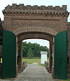
Sally Port. |
 |
|
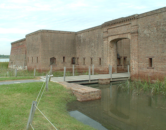
Sally Port, West Demi-Bastion. |
 |
|
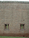
General View, West Crenellated Wall and Demi-Bastion. |
 |
|
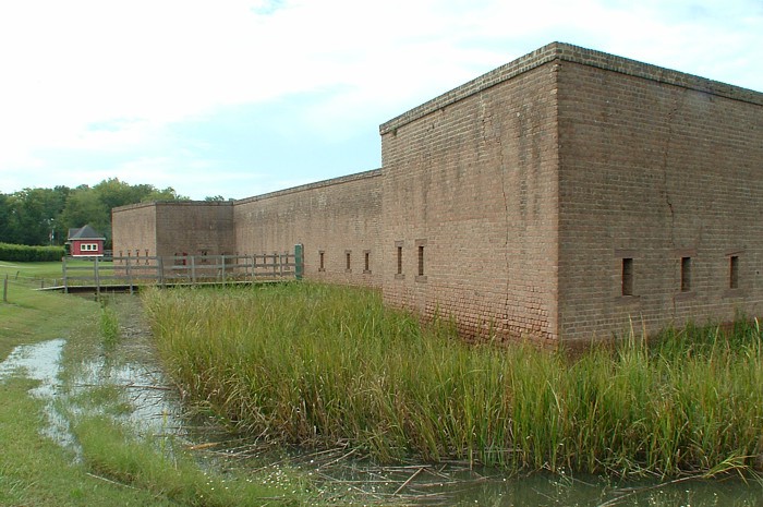
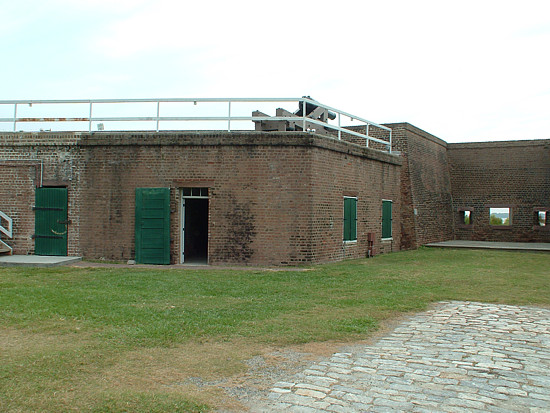
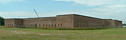
General View, West and South Fronts. |
 |
|
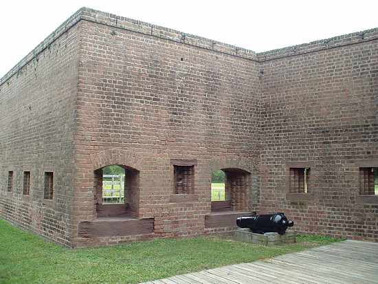
General View, South Bastion Front, East Front. |
 |
|
South Bastion Front. |
 |
|
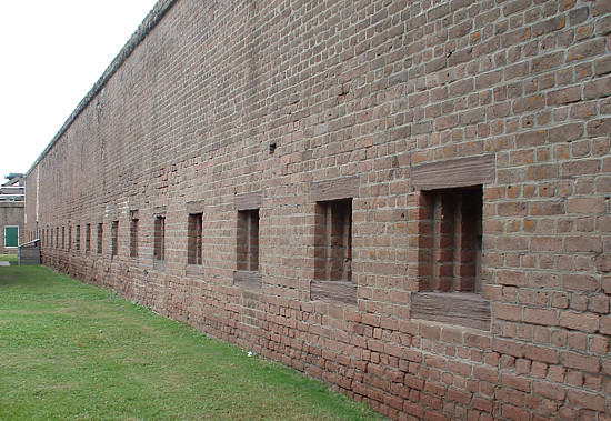
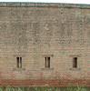
East Crenellated Wall, Looking North. |
 |
|
East Demi-Bastion, East Faces Water Battery. |
 |
|
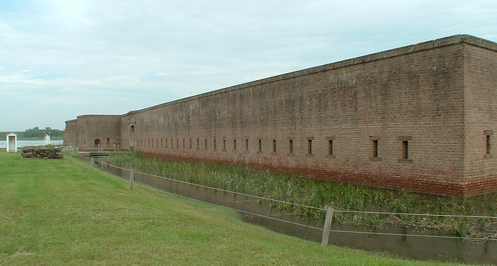
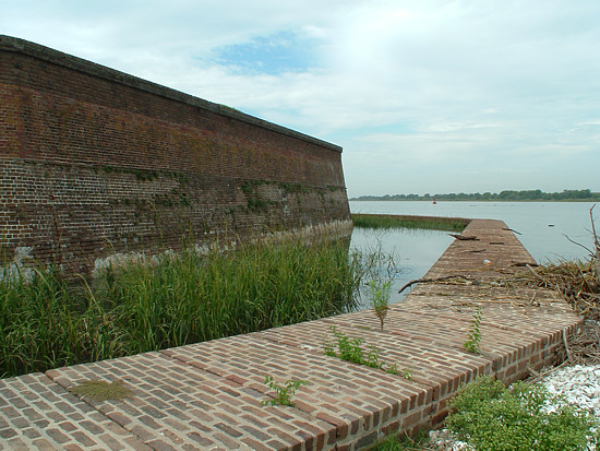
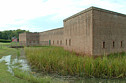
East Faces, Water Battery and River Side Wet Ditch Wall. |
|
|
|
~ Interior Views ~ |
 |
|
Sally Port. |
 |
|
Sally Port Enclosure, North Side. Granite Drawbridge Mechanism Retainer. |
 |
|
Sally Port Enclosure, South Side. |
 |
|
1845 Powder Magazine. |
 |
|
Power Magazine, Parade Wall of Casemate Gallery of Water Battery. |
 |
|
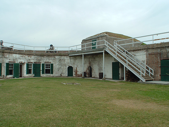
Casemate Gallery, Water Battery. |
 |
|
East Side Casemate Gallery, Water Battery. |
 |
|
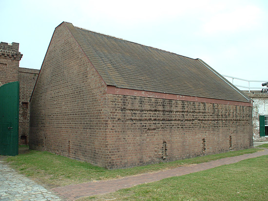
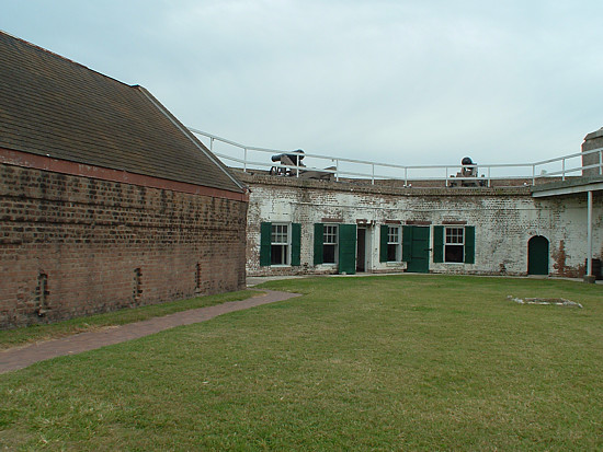
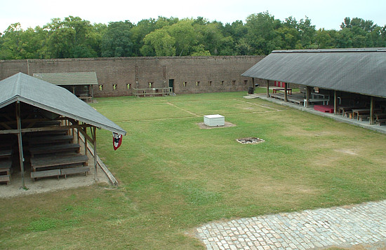
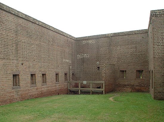
South Front Wall and Parade. (Pavilions mark masonry barrack positions). |
|
|
|
~ Loop-Holes ~ |
 |
|
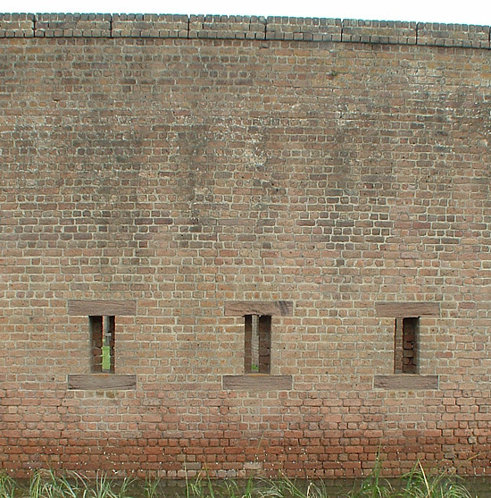
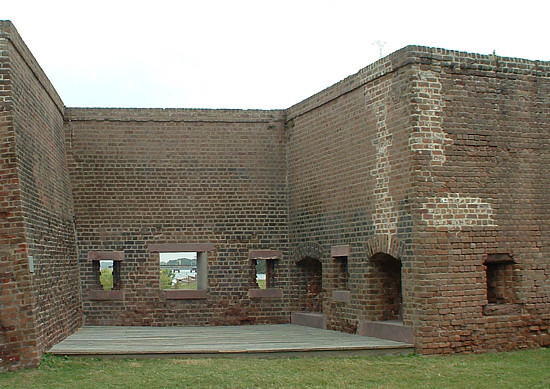
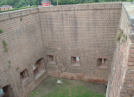
East Crenellated Wall, Interior, Looking North. |
 |
|
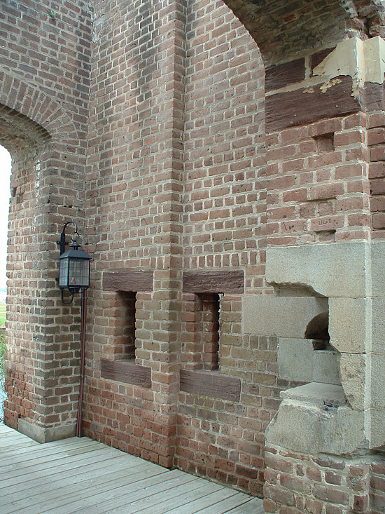
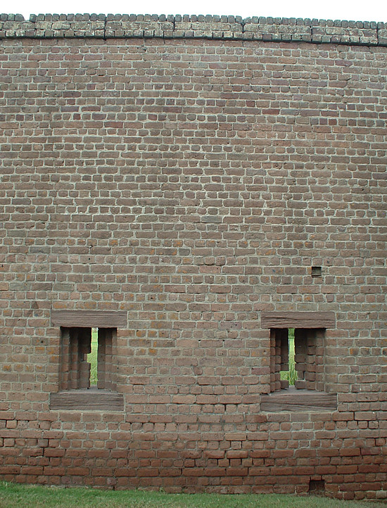
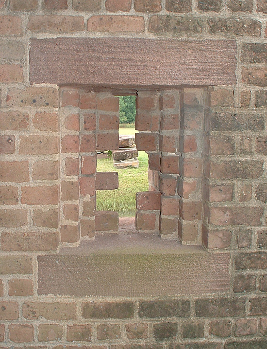
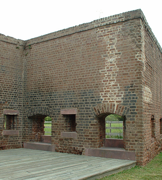
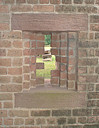
Interior Loop-Holes. |
 |
|
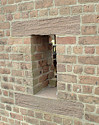
Exterior, Loop-Holes. |
 |
|
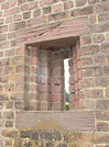
Loop-Hole, Interior. |
 |
|
Interior Side of Loop-Hole Looking Upward. |
 |
|
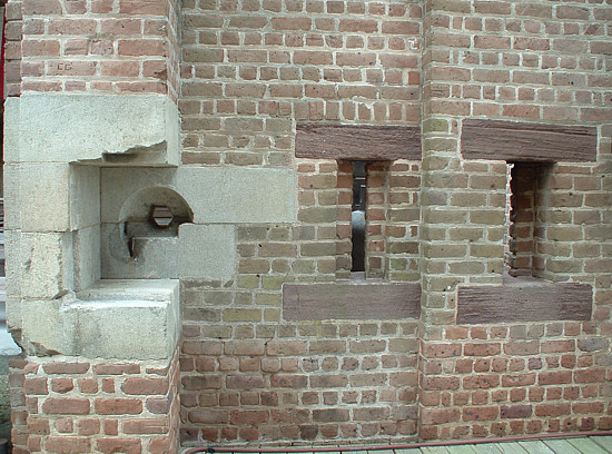
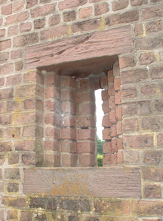
Exterior View of East Crenellated Wall Loop-Hole. |
 |
|
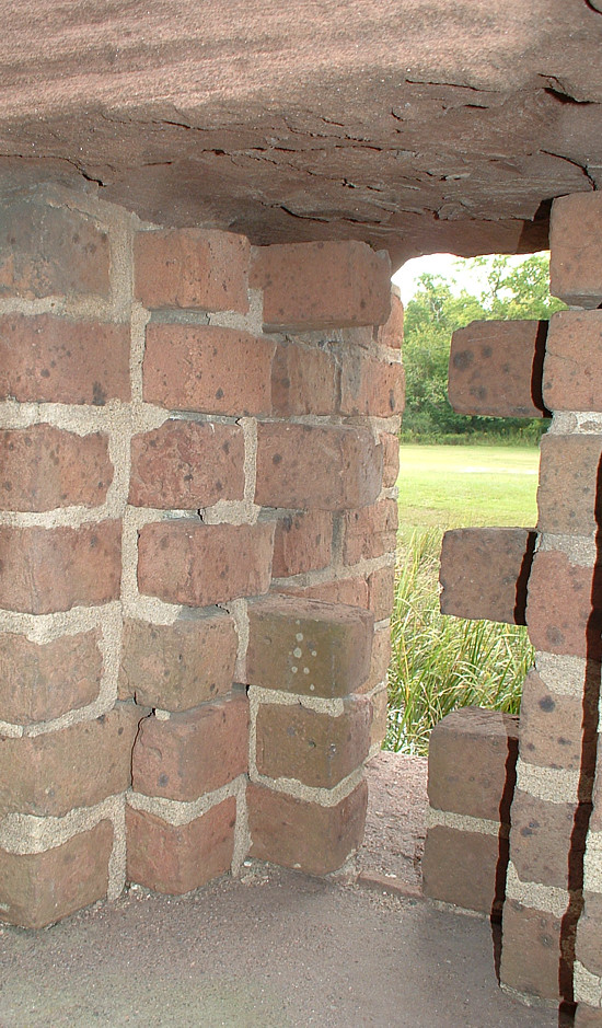
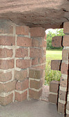
Detail of Masonry Interior Arrangement of a Loop-Hole. |
|
|
|
~ Demi-Bastions ~ |
 |
|
Southwest Demi-Bastion. |
 |
|
Southeast Demi-Bastion. |
 |
|
East Demi-Bastion. |
 |
|
East Demi-Bastion, Flank Embrasures and Loop-Hole. |
 |
|
West Demi-Bastion. |
|
|
|
~ Maps and Charts ~ |
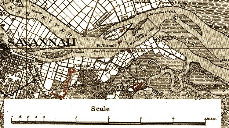 |
Detail from Map Illustrating the Defence of Savannah, GA. and the
Operations Resulting in Its Capture by the Army Commanded by Maj. Genl. W.
T. Sherman. (1880-81) |
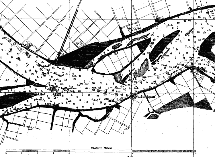 |
Detail from Preliminary Chart of Savannah River Georgia (1855) |
|